Overview
CENTRAL AMERICA'S MOST COMPELLING COMEBACK
El Salvador may be the smallest country in the Americas, but it delivers a surprisingly rich mix of landscapes, culture, and adventure.
Known as the “Land of Volcanoes,” the country features dramatic volcanic peaks rising above the Pacific coastal plain, with some of the most consistent surf breaks in all of Central America. Izalco Volcano — once dubbed the “Lighthouse of the Pacific” for its near-constant eruptions — anchors Cerro Verde National Park alongside the striking Santa Ana Volcano, which holds a turquoise crater lake at its summit.
El Salvador also has over 1,500 recorded archaeological sites, including Joya de Cerén — a UNESCO World Heritage Site often called the “Pompeii of the Americas” for its remarkable preservation of an ordinary Maya village buried in volcanic ash. Surf tourism has surged around La Libertad and El Tunco, and a new generation of boutique hotels and restaurants has opened in San Salvador and along the coast. Travel distances are short: in a single trip, travelers can move easily between capital, beach, and volcano.
Best for travelers looking for something authentic, emerging, and still relatively undiscovered — dramatic volcanoes, excellent surfing, unique archaeology, easy logistics, and a country that rewards those who show up with curiosity rather than expectations.
Geography
WHERE EVERYTHING IS
El Salvador is compact enough to cover extensively in a single trip. The capital San Salvador sits in the central highlands; the volcanic chain runs east–west across the country; the Pacific coast is 30–60 minutes south of the capital. Crater lakes, archaeological sites, and surf beaches are all within a few hours of each other. Click any marker for details.
Tap or click markers for details. Pinch / scroll to zoom.
Why Go
WHAT MAKES EL SALVADOR STAND APART
Volcano Country
More than 20 volcanoes define El Salvador’s landscape. Hiking Santa Ana Volcano to a turquoise crater lake is one of the finest day hikes in Central America. Izalco’s perfect cone and the views from Cerro Verde reward the effort from any angle.
World-Class Surfing
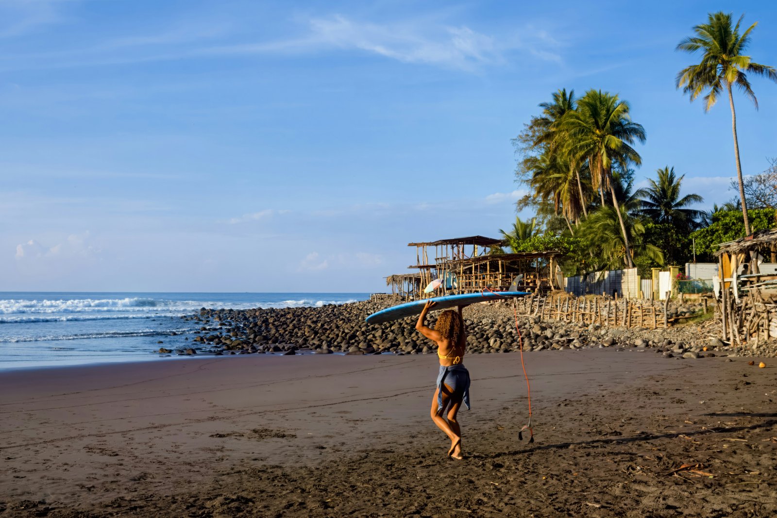
La Libertad and the beaches surrounding it — El Tunco, El Zonte, Punta Roca — produce consistent, powerful breaks that have drawn serious surfers for decades. The surf scene is well-organized, with lessons and board rentals readily available alongside quality beachside accommodation.
Joya de Cerén
A UNESCO World Heritage Site unlike any other Maya site in the region. Rather than pyramids and ceremonial plazas, Joya de Cerén preserves the homes, kitchens, gardens, and personal possessions of ordinary Maya villagers buried by a volcanic eruption around 600 AD. A rare, intimate window into daily life.
Crater Lakes
Lake Coatepeque — considered one of the most beautiful lakes in Central America — fills a volcanic caldera with deep blue water surrounded by private properties and a few excellent hotels. Lake Ilopango, a vast crater lake near the capital, and the smaller geothermal Lake Alegría round out an extraordinary volcanic lake circuit.
Easy Logistics
Everything in El Salvador is close. The capital is 30–60 minutes from the beach, 45 minutes from the main volcanoes, and a couple of hours from most archaeological sites. Rental cars are affordable, roads between major destinations are generally good, and Uber operates in San Salvador.
Pupusas & Coffee
El Salvador’s national dish — the pupusa, a thick stuffed corn tortilla — is one of the great street foods of Latin America, found everywhere and always excellent. Salvadoran coffee is among the finest in Central America, grown at altitude in the volcanic highlands and exported worldwide.
Top Experiences
PLAN AROUND EXPERIENCES, NOT JUST REGIONS
Hike Santa Ana Volcano
El Salvador’s finest day hike — a guided ascent of the country’s highest volcano to a stunning turquoise crater lake ringed by sulfurous vents. The trail passes through cloud forest before opening to volcanic rock and sweeping views across the crater. Guides are required and departures are organized from the Cerro Verde National Park entrance.
Surfing La Libertad
The La Libertad coast — El Tunco, El Zonte, Punta Roca, El Sunzal — is El Salvador’s surf heartland. Punta Roca produces one of the longest and most powerful right-hand point breaks in the Pacific. The area has grown from a rough surfer hang-out into a destination with quality hotels, seafood restaurants, and full surf infrastructure for all levels.
Joya de Cerén
The “Pompeii of the Americas” — a Maya farming village preserved under volcanic ash since approximately 600 AD. Walking the excavated site, visitors see thatched-roof structures, ceramic vessels, food stores, and garden plots exactly as they were left when villagers fled the eruption. One of the most historically intimate archaeological experiences in all of Latin America.
Lake Coatepeque
A deep volcanic crater lake considered one of the most beautiful in Central America. Private properties line much of the shore, but a handful of hotels offer lake access, and the views from the rim road above are extraordinary. An easy day trip from San Salvador or Santa Ana, it pairs well with the Cerro Verde volcano complex nearby.
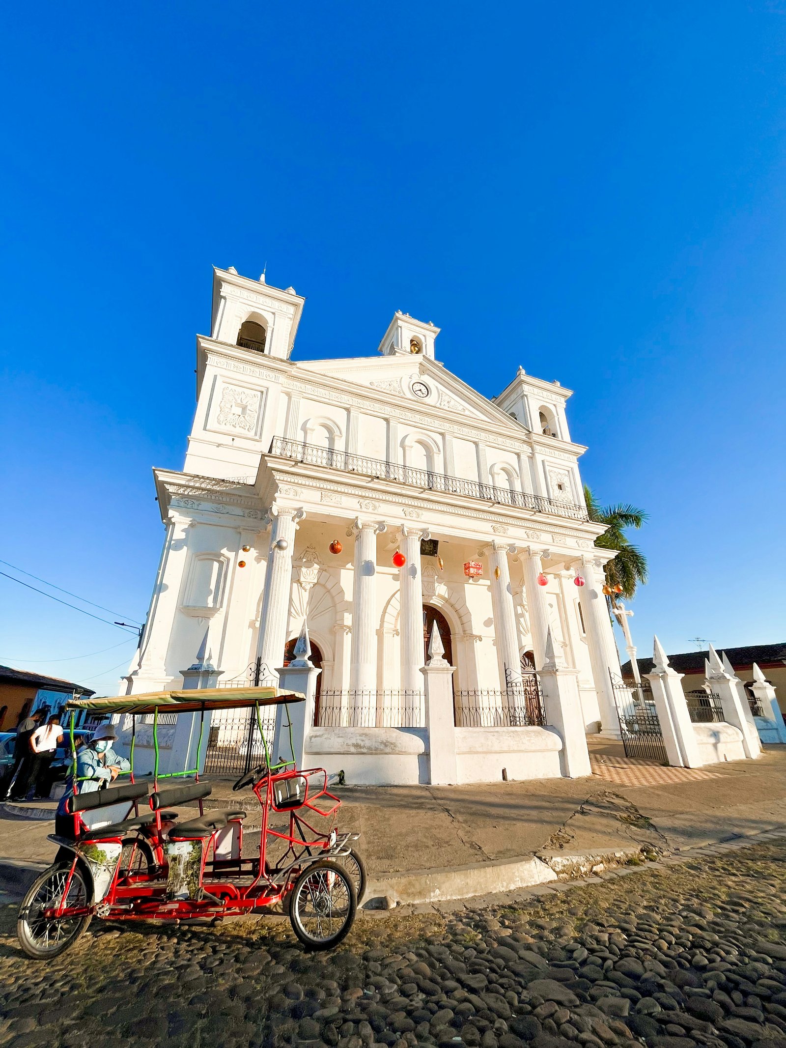
San Salvador
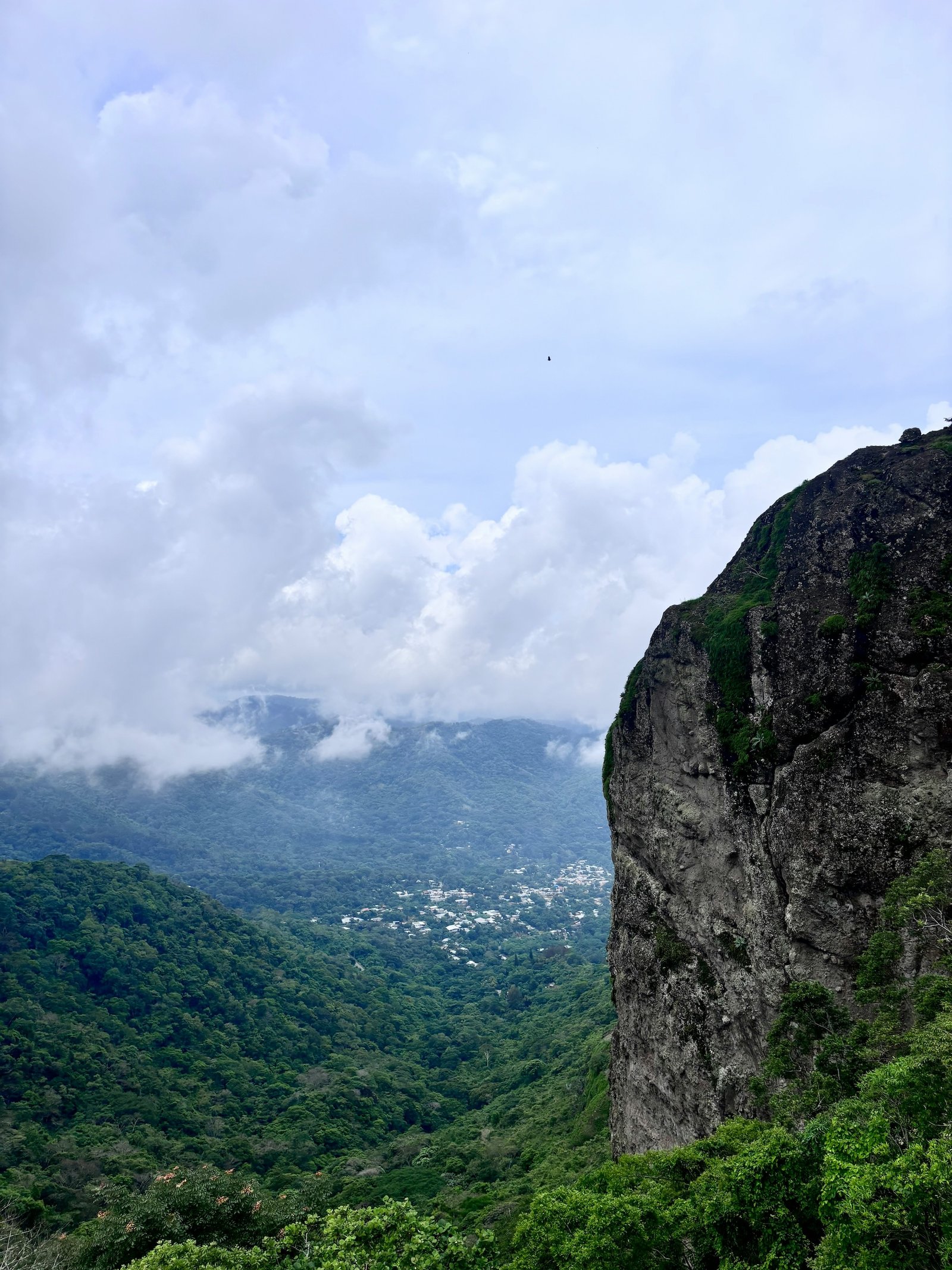
A modernizing capital with a growing restaurant and bar scene, concentrated in upscale neighborhoods. The Metropolitan Cathedral and the National Palace anchor the historic downtown. Puerta del Diablo — a dramatic rock formation on the outskirts of the city — offers sweeping views of the capital and Pacific coastline and is a popular local weekend destination.
Tazumal
The largest excavated Maya site in El Salvador, located near the town of Chalchuapa close to Santa Ana. The main pyramid is well restored, and the on-site museum holds artifacts from the surrounding region. A good complement to Joya de Cerén for travelers with an interest in pre-Columbian history.
Deep-Sea Fishing
The Pacific waters off El Salvador are known for excellent deep-sea fishing, particularly for billfish — marlin, sailfish, and swordfish. La Libertad and the Costa del Sol are the primary departure points, with well-organized charter operators. Catch-and-release is widely practiced.
Ruta de las Flores
A highland route through a string of small colonial towns — Juayúa, Apaneca, Ataco, Concepción de Ataco — known for craft markets, flower-lined streets, weekend food festivals, and cool mountain air. The weekend food festival in Juayúa is one of the best in Central America for regional Salvadoran cuisine.
Timing
WHEN TO VISIT EL SALVADOR
Dry Season (Best Overall)
November through April is El Salvador’s dry season — clear skies, good surf conditions, ideal hiking weather for the volcanoes, and the best overall window for most activities. December and January are particularly pleasant.
Surf Season
Surfing is good year-round at La Libertad, but the April through October period tends to produce the largest and most powerful swells. The dry season still delivers consistent surf; the wet season adds size. Advanced surfers often prefer the May–September window.
Wet Season
May through October brings regular afternoon rainfall, keeping the highlands and volcano slopes lush and green. Rain is rarely an all-day affair. Volcano hikes and archaeological sites remain accessible; the Santa Ana hike can be muddy after heavy rain.
Semana Santa
Holy Week (Easter) is a major event in El Salvador — beaches and lakeside towns fill to capacity. Book accommodation well in advance if visiting during this period. The religious processions in some towns are well worth witnessing for their cultural depth.
Travel Essentials
FACTS & PRACTICAL DETAILS
SAFETY ADVISORY
El Salvador has undergone a dramatic transformation in public safety in recent years, with crime rates dropping significantly and major tourist areas now considered relatively safe. Visible law enforcement presence is widespread throughout the country.
Standard precautions remain advisable: use registered taxis or ride apps rather than unmarked cabs, avoid isolated areas without local guidance, and stay aware in crowded markets. The surf coast, volcanic highlands, archaeological sites, and the better neighborhoods of San Salvador are regularly and comfortably visited by international travelers. Check current U.S. Department of State advisories before departure, as the situation continues to evolve.
Key Areas
A SIMPLE GEOGRAPHY OF EL SALVADOR
San Salvador
The modernizing capital sits in a highland valley at about 2,200 feet, ringed by volcanoes. The historic downtown holds the Metropolitan Cathedral, National Palace, and Plaza Barrios. Upscale neighborhoods — Zona Rosa, Colonia Escalón, and San Benito — have the country’s best restaurants, bars, and hotels. Puerta del Diablo on the city’s southern edge offers panoramic views across the capital and all the way to the Pacific on clear days.
Volcanoes & Crater Lakes (Central Highlands)
The volcanic chain running east–west across the country is El Salvador’s most dramatic landscape. Cerro Verde National Park gives access to the hikes up Santa Ana Volcano and views of Izalco. Lake Coatepeque fills a volcanic caldera nearby. Lake Ilopango — a vast crater lake east of the capital — is an easy half-day trip. The smaller Lake Alegría in the east is known for its geothermal activity and remote highland setting.
Pacific Coast (La Libertad & Costa del Sol)
The surf coast is 30–60 minutes south of the capital and among the most accessible in Central America. La Libertad is the hub — a working fishing port with good seafood and easy connections to the surf beaches. El Tunco, El Zonte, and El Sunzal have the best concentration of surf camps, hostels, and beachside restaurants. The Costa del Sol, to the east, is a more traditional beach resort area known for calmer waters, fishing, and weekend retreats for Salvadorans.
Archaeological Sites
Joya de Cerén — UNESCO World Heritage Site and one of the most extraordinary archaeological experiences in Latin America — is about 35 kilometers west of the capital. Tazumal, near Chalchuapa and Santa Ana, is the largest excavated Maya site in the country. San Andrés, between the capital and Santa Ana, is another excavated ceremonial center worth a stop for travelers with archaeological interest.
Ruta de las Flores (Western Highlands)
A highland circuit through small colonial towns — Juayúa, Apaneca, Ataco, and Concepción de Ataco — at elevations between 3,000 and 5,000 feet. The towns are known for cobblestone streets, painted murals, handicraft markets, and weekend food festivals. The Juayúa Food Festival (every weekend) is one of the best showcases of regional Salvadoran cuisine. Coffee farms in this region offer tours during the harvest season (November–February).
Parks & Wildlife
PROTECTED LANDS & NATURAL WONDERS
El Salvador is the most densely populated country in Central America, but its volcanic landscapes and remaining forests support meaningful wildlife and several well-developed protected areas.
Cerro Verde National Park
The base for El Salvador’s finest volcano hiking — trails lead to the summit of Santa Ana Volcano (crater lake at top) and to viewpoints above the perfect cone of Izalco. Cloud forest on the upper slopes supports a good range of highland birds. Guides are available and required for the Santa Ana summit hike.
El Imposible National Park
El Salvador’s largest national park, in the southwest of the country — a rugged highland forest with exceptional biodiversity, including over 400 bird species. The park is less visited than the volcano areas and rewards hikers willing to explore with wildlife encounters and genuine wilderness.
Montecristo Cloud Forest
In the far northwest where El Salvador, Guatemala, and Honduras meet — a cloud forest reserve at elevations above 7,000 feet. The forest is dense with moss, orchids, and ferns; howler monkeys and spider monkeys are present. Access requires advance arrangements but offers a remote and atmospheric highland experience.
Joya de Cerén (UNESCO)
While primarily an archaeological site, Joya de Cerén is protected as a World Heritage Site for both its cultural and geological significance. The preserved stratigraphy of repeated volcanic deposits tells a detailed story of how the Tierra Blanca Joven eruption transformed the landscape of what is now El Salvador.
Crater Lakes Circuit
Lake Coatepeque, Lake Ilopango, and Lake Alegría are all volcanic crater lakes of different character — deep blue caldera, vast mountain lake, and steaming geothermal pool respectively. Together they form a natural circuit through El Salvador’s volcanic geology that no other country in the region can match.
Pacific Marine Habitats
The Pacific coast supports sea turtle nesting (primarily leatherback and olive ridley), and several community conservation projects offer supervised nesting and hatchling release experiences. Migratory whale sightings are possible offshore from December through April. Deep-sea fishing for billfish is excellent year-round.
Traveler Questions
EL SALVADOR TRAVEL FAQ
Is El Salvador safe to visit?
El Salvador has undergone a dramatic security transformation since 2022, with a government crackdown that dramatically reduced gang activity and violent crime. The country’s murder rate fell sharply and many previously off-limits areas have reopened to travelers. The situation is real and widely reported, though some human rights concerns about mass incarceration policies accompany the security gains. El Salvador is now welcoming tourists at levels not seen in decades — surf towns like El Tunco and El Zonte are thriving.
What is El Salvador best known for with travelers?
Surfing is the headline attraction — the Pacific coast from La Libertad to El Zonte offers world-class point breaks, including Punta Roca, one of the most consistent left-hand waves in Central America. Beyond surf culture: Santa Ana and its crater lake, the Mayan ruins at Tazumal, the colonial city of Suchitoto on Lago Suchitlán, and the Ruta de las Flores through coffee-growing highland villages.
Does El Salvador use the U.S. dollar?
Yes. El Salvador adopted the U.S. dollar as official currency in 2001, which makes it extremely convenient for U.S. travelers — no currency exchange needed. The country also became the first nation to adopt Bitcoin as legal tender in 2021, though dollar cash remains the practical standard for most transactions.
How many days do you need in El Salvador?
El Salvador is small — the entire country fits comfortably in a week. Four to five focused days will cover the main highlights: a day around Santa Ana, a day in Suchitoto, two days on the coast, and time in or near San Salvador. Surfers often stay longer, anchoring in El Zonte or El Tunco for extended sessions. Because of its size and good roads, day trips across regions are genuinely feasible.
Local Operators
Tours & Adventure
Salvadorean Tours
San Salvador–based operator running since 2006 — full-day and half-day tours covering Santa Ana Volcano, Ruta de las Flores, Suchitoto colonial town, Maya ruins (Joya de Cerén, Tazumal), El Imposible National Park, and the surf coast at El Tunco and El Zonte.
Best for: First-time visitors and independent travelers wanting a reliable, well-organized operator for El Salvador’s highlights.
Tunco Life
Locally owned operator based on the Pacific coast — covering volcano hikes (Santa Ana, Izalco), Ruta de las Flores day trips, Suchitoto cultural tours, and surf packages along the Balsam Coast. Works with small independent groups and partners with G Adventures.
Best for: Travelers who want a local, community-rooted operator for volcanoes, colonial towns, and the surf coast in one place.
Latin Travel does not book tours directly. These are editorial selections. Please mention Latin Travel when you contact them — it helps us keep this guide current.